")

Digital Tools for Diocese Property Assessment Planning
Many churches were established to serve communities that have changed significantly over time. Today, shifts in demographics, transition of property from residential to rental ownership, environmental factors such as flood exposure, and the transition of the focus of community activities present new challenges for long-term church property stewardship and planning.
Earth Systems Management provides aerial drone imaging, laser scanning, GIS analysis, 360° image documentation, and public mapping data to help churches better document, evaluate, and understand their properties and their relationship to their surrounding communities.
Capabilities.
High-resolution orthomosaic imagery and laser scanning for:
- Roof condition assessment
- Steeple and bell tower inspection and assessment
- Drainage and erosion observation
- Cemetery documentation and maintenance
- Vegetation encroachment mapping
- Historic structure documentation and production of architectural CAD drawings.
Reduce the need for expensive manual inspections while improving documentation quality and safety.
Provide training and data-processing support services.
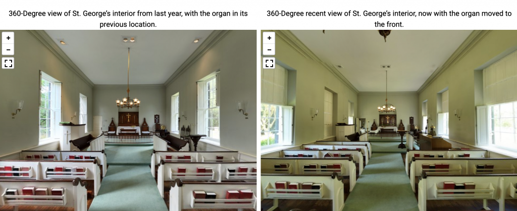
Click the preview image below to view the interactive 360° panorama.
Viewing Notice: This 360° image is high resolution and may require more graphics processing power than some older phones can support. If the viewer does not load properly, please try opening it on a newer device or desktop browser.
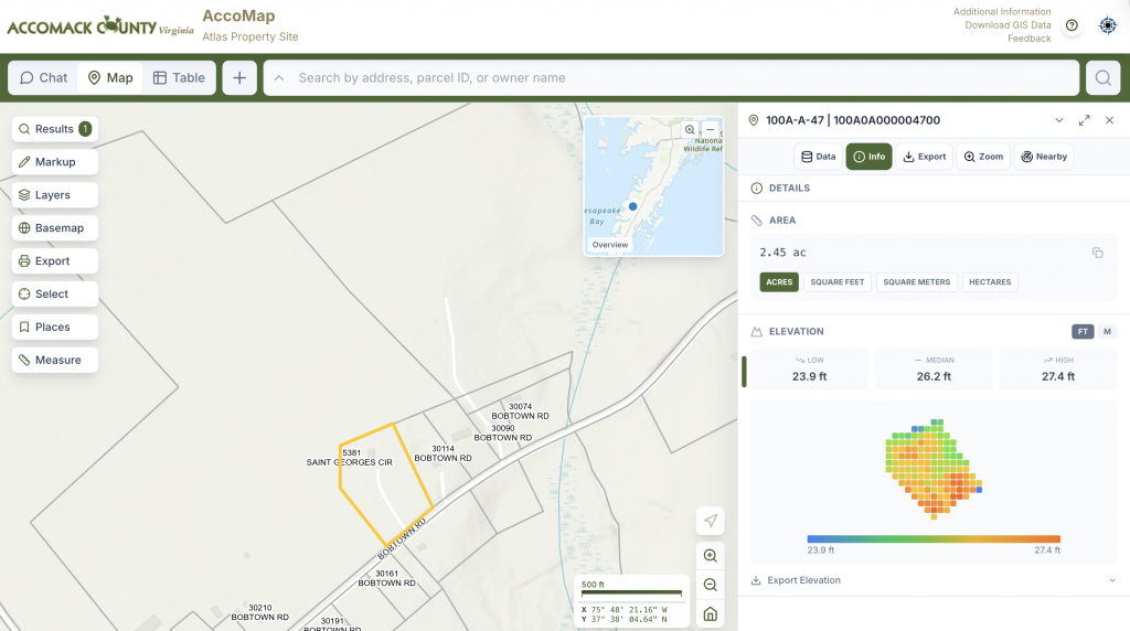
GIS & County Mapping Data
Public GIS datasets provide additional insight into elevation, flood exposure, parcel ownership, surrounding land use, and long-term community changes.
Demographic & Community Change
Many historic church communities are experiencing major demographic shifts:
- Declining permanent residency
- Increase in seasonal or second-home ownership, resulting in reduced year-round participation
- Aging populations
- Migration away from historic town centers
- Changes in economic base and local industry
In some communities, a significant portion of surrounding properties may now be owned by non-resident or seasonal occupants, fundamentally changing how a parish interacts with its local population.
Why Some Churches Stay Alive - they are available to convey the gifts of Christ
Through engagement with:
- attracting young people and families
- weddings/events
- outreach ministries
- bilingual
- tourism
- historical significance
- destination parish
- retirees
- summer residents
- regional draw
- strong donor base
- community partnerships
GIS and demographic analysis can help identify why certain churches continue to thrive despite significant local population changes, revealing patterns in accessibility, regional draw, historical significance, and community engagement.