Click on the site navigation chart for easy access to the links.
Marina Documentation
Detailed Aerial & Underwater Marina Reports
At Earth System Management, LLC, we provide high-resolution marina documentation using aerial drones, hydro drones, and 360-degree cameras. Our services capture detailed imagery and video of docks, piers, bridges, and other waterfront infrastructure, offering an unmatched perspective above and below the water. This comprehensive documentation supports maintenance planning, structural assessments, and long-term monitoring in ways that traditional inspections simply can’t match.
Why Choose Our Marina Documentation Services?
Our HydroDrone was developed by a team of young adults passionate about advancing marine technology. Paired with our aerial drone systems, we offer a powerful combination for comprehensive marina documentation. The HydroDrone is haul-independent, lightweight, and easy to deploy—one person can handle launching it into the water. This innovative design allows for greater flexibility and accessibility in marine monitoring and structural inspections.
With our autonomous hydro drones, we also provide bathymetric mapping for marinas, ensuring precise depth measurements and underwater analysis. By offering different drone configurations, such as kayak and paddleboard-based models, we adapt to various environments while maintaining high accuracy and efficiency.
Our rapid deployment capability ensures you get the information you need when you need it. By conducting regular documentation, we provide a historical record that aids in verifying structural conditions after an incident or failure.
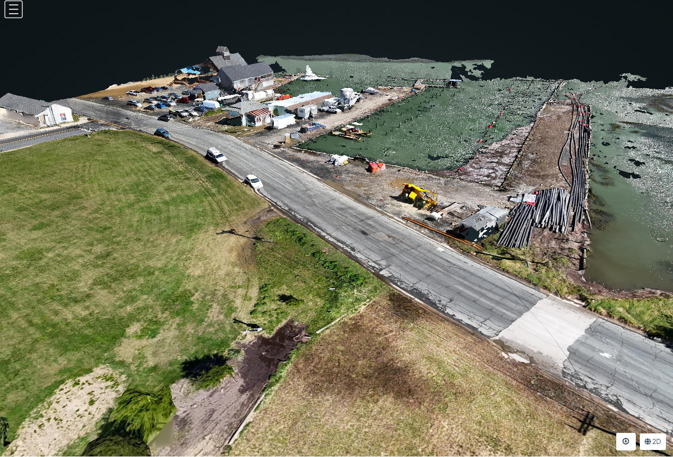
Wachapreague Town Marina: Integrated Topobathy & 3D Mapping Project. Click to view
Our marina documentation solutions include:
✅ Comprehensive Aerial & Underwater Footage – Capture clear, high-resolution images and videos of structures from every angle. ✅ HydroDrone Bathymetric Mapping – Conduct precise depth and underwater terrain mapping for marinas. ✅ Versatile HydroDrone Options – Our autonomous HydroDrones come in different versions, including kayak and paddleboard designs, to fit any environment. ✅ Autonomous & Repeatable Missions – Ensure consistent, comparable footage over time for tracking changes. ✅ Storm & Damage Assessments – Quickly document conditions before and after severe weather events. ✅ Historical Record for Verification – Maintain an archive of structural integrity for insurance, compliance, or restoration purposes.
📌 Interested in our services? You can click here to fill out a contact form and we will get back to you as soon as possible.
")