")

Burton’s Bay Bathymetric Mapping for VIMS
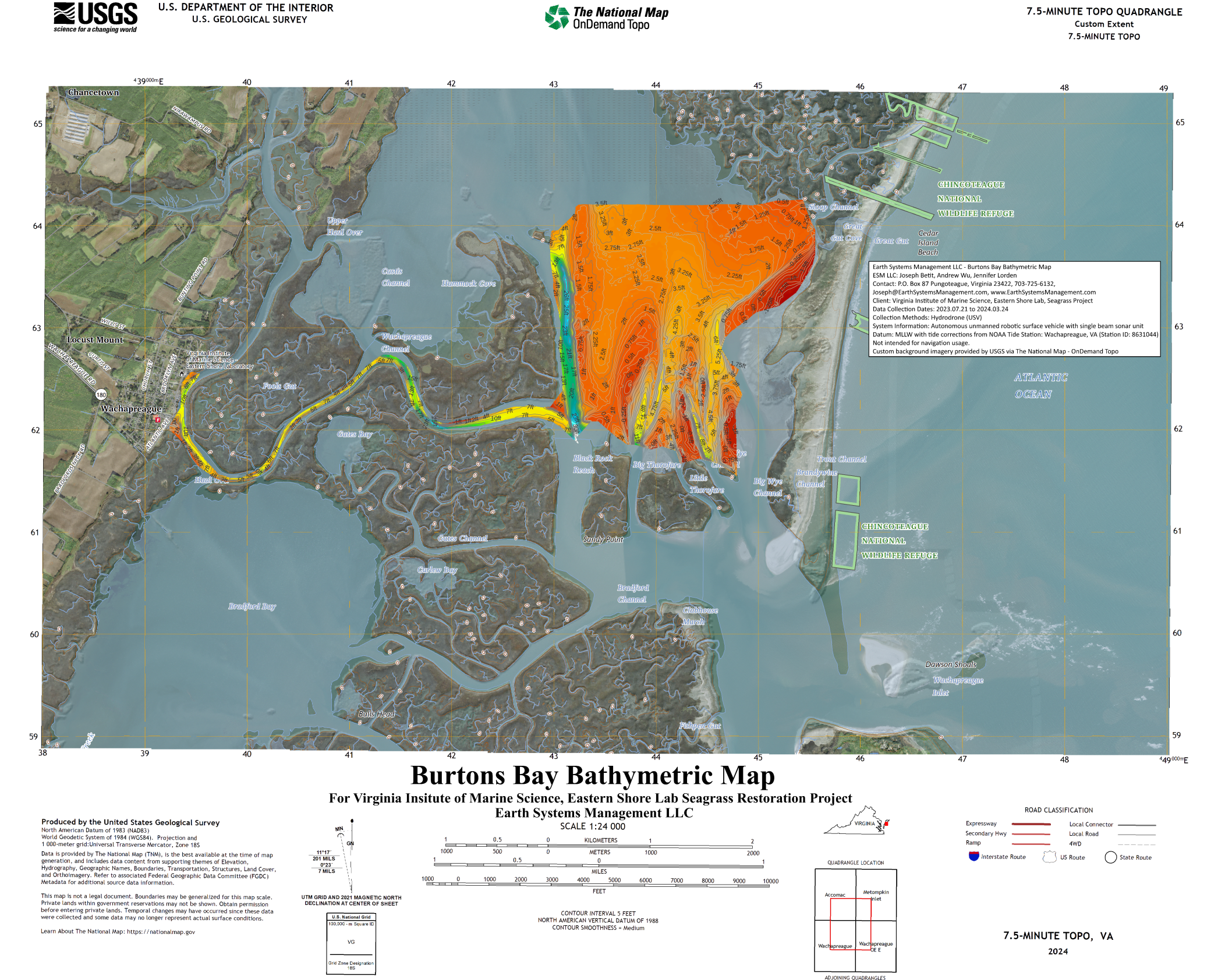
Betit, Joseph; Wu, Andrew; and Lorden, Jennifer, “Burtons Bay Bathymetric Map” (2024). Data. William & Mary. https://scholarworks.wm.edu/data/694
At Earth Systems Management, LLC, we created a detailed bathymetric map of Burton’s Bay to support the seagrass restoration efforts led by the Virginia Institute of Marine Science (VIMS). Using our custom-built autonomous HydroDrone, we conducted a series of surveys to collect high-resolution depth and terrain data. After processing this data, we delivered it to VIMS, which later published it on William & Mary’s ScholarWorks for public access. This project demonstrates our commitment to marine science and environmental restoration, as well as our dedication to fostering innovation among young adults on the Eastern Shore. Click here to view the publication.
Click here to view the Interactive Map.
Please note that some phones may not support MapHub, so we recommend viewing it on a computer for the best experience.